Showing posts with label Meghalaya. Show all posts

Monday, October 2, 2023

The Mysterious Garo Hills


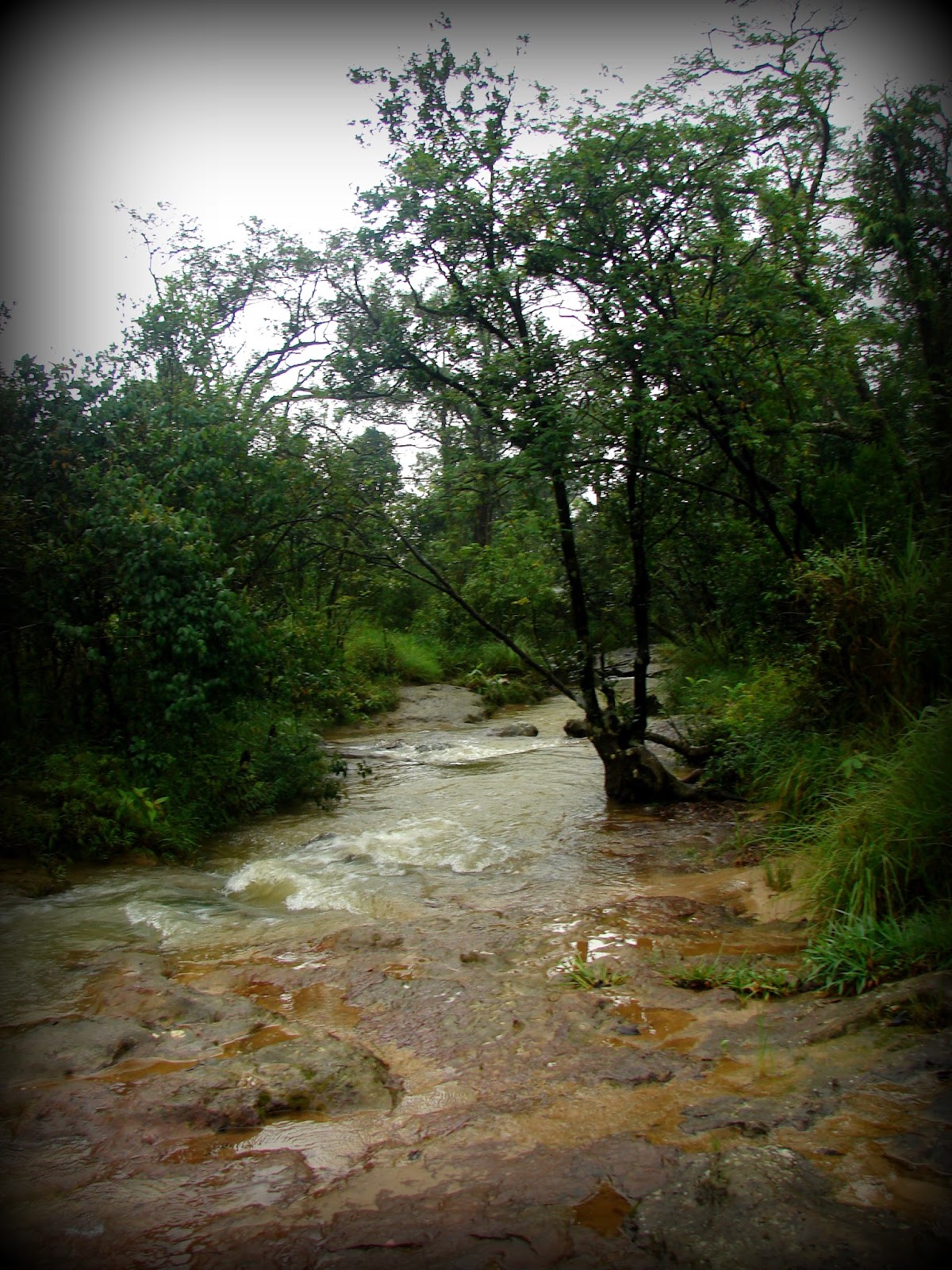
Wari Chora in Garo Hills. Source of photograph: Official Meghalaya Tourism Facebook Page. One can reach Wari Chora from Baghmara. The Wari Chora homestay is about 1.5 hours by road. The trek point is an off-road drive of another 10-15 minutes. The descent trek is about 1-2 hours depending on one's stamina and ability to trek through forests. The ascent back is about 2-3 hours. The canoe ride and exploration at the canoe, waterfall, and river takes about 2-3 hours

Garo Hills are one of the most unexplored parts of our country. My father tells us stories of his adventurous trips to the beautiful caves and rivers hidden in these hills. The photographs I saw on the Meghalaya Tourism website are absolutely intriguing and I can't wait to visit these mysterious mountains. However, getting the permission to go there will be one big task. Till now my parents did not allow me to venture to that side rather scared me off it. According to them, it's pretty dangerous and unsafe. I googled a bit and yes, this part does sound difficult in terms of infrastructure (but I guess as long as development does not reach there, these hills will remain gorgeous) and insurgencies. People have been abducted and the tribes in these areas can be pretty intimidating for outsiders, I guess (However, I may be wrong since I have been mostly discouraged from traveling to that part of the country). Can't blame them! As has happened in other parts of the world, the tribes were uprooted from their very homeland in the name of development like one of the Khasi groups called Diko are extinct. Guess, it will take a while to figure out how to reach the hidden sanctuaries of these hills before development encroaches on them to mutilate their existence. People have visited and am sure I can as well pretty soon. 

Karukol in Garo Hills. Source of photograph: Official Meghalaya Tourism Facebook Page 

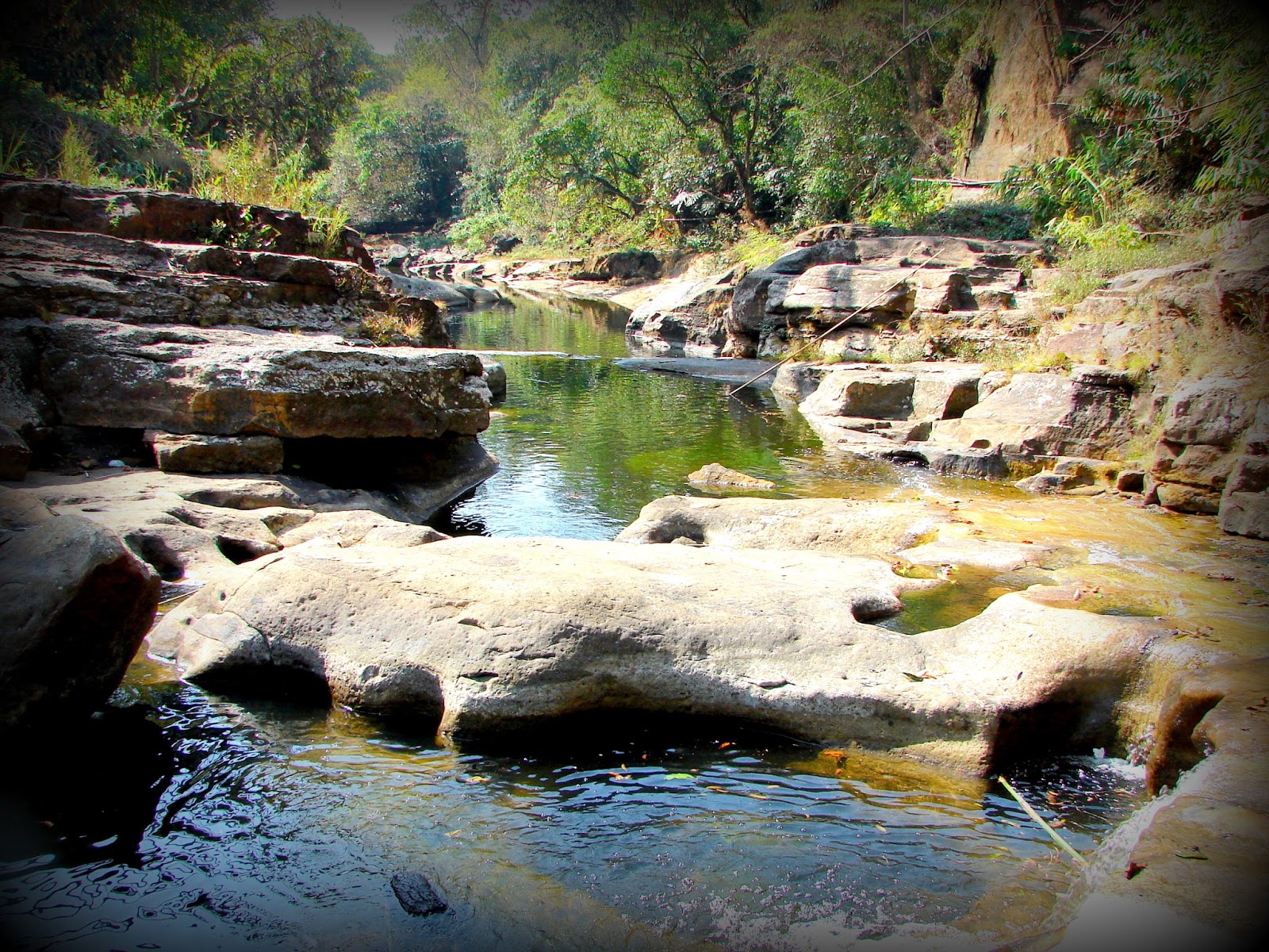
Simsang River in Garo Hills. Source of photograph: Official Meghalaya Tourism Facebook Page 

Places of Interest in the Garo Hills

The course of the Simsang River. It has its origin in the Nokrek range, then flows down south into Bangladesh where it is called Someshwari

Origin of the Garos

The origin of Garos is not well documented due to unavailable resources. Garo's history has been passed on through generations orally in the form of stories and legends. Ancient Garo scripts are lost and in recent times, English is their adopted script. The little that has been researched about their origin, suggests that the tribes probably migrated from Tibet. The similarities in language and traditions incline towards the theory. Garo's consider Yak tails sacred which is prevalent in Tibet and regions where Yak's are found. However, Yak is not native to the mountains of Meghalaya or other Garo habitats which further supports the theory, that their ancestral trail must have led to Tibet. Many Garo legends suggest similar stories of their migration from far Northern mountains. Small Garo Villages along the river routes even in the present day, lean towards these migration theories.

Many historians believe different Tibetan tribes migrated to Garo Hills following the course of the Brahmaputra River. Some even detoured toward present-day Sikkim and followed the course of the Teesta River. It is suggested one of the first settlements of Garos was Cooch Behar. They were later driven out from there by the Koch rulers. They moved East to Jogighopa and then to Dalgoma. From Dalgoma they moved South to Garo Hills. 

Other historians believe the Tibetan tribes followed the Salween River from its source and moved towards Myanmar. There they followed the course of Chindwin and Irrawaddy Rivers to reach the Mandalay region of Myanmar where they settled down as farmers. Some tribesmen later moved west and crossed over to Dimapur. From Dimapur, some went North towards Northeast Assam and some went towards Garo Hills.

Probable routes of Garo Migration to Meghalaya from Tibet 
The name Garo was coined by the natives for the migrant tribes. The origin of the name Garo is unknown or rather obscure. Some say stepped farmers were called Gari which later changed to Garo. Some connect the name to Garuda tribes and some connect it to Gara-Ganching tribes. Originally the Garos called themselves Achik Mande which means the hill people. The indigenous Garos were nature worshippers and they followed a religion called Songsarek. In recent times, most Garos have converted to Christianity. 

Like the Khasis and Jaintias, the Garos are also matrilineal and matrilocal but not matriarchal. The family name and the property are passed on through a chosen daughter of the family. In the absence of a daughter, a daughter is adopted from the mother's sister's side. After marriage, the groom moves to the bride's family and takes over the responsibilities of the bride's family. The Garos are divided into five exogamous clans called 'chatchis' or 'katchis' - The Marak, The Momin, The Sangma, The Arengh, and The Shira. Each clan is further divided into several septs called 'Machongs'. Marriages are strictly prohibited in the same chatchi. However, in modern times, many just follow marriage prohibition within the same 'machong'. I think the prohibition in marriages within 'chatchi' should have been strictly followed since it prevents inbreeding and recessive genetic mutations in offspring.

There are about 12 sub-tribes of Garos based on their dialects and geographical location: Ambeng/Abeng, A.tong, A.we, Chibok, Chisak, Dual, Gara-Gaching, Koch, Matabeng, Matchi, Matchi-Dual, Megam, and Ruga.

Distribution of sub-tribes in Garo Hills

Shiju Bat Caves - Source of photograph: Official Meghalaya Tourism Facebook Page. One can reach Shiju bird sanctuary and caves from Baghmara in about 1.5 hours drive

How and when to travel to the Garo hills

I heard from travelers that it is not very easy to get to the caves, waterfalls, and canyons. Most places need a good amount of medium-range trek through deep forests full of leeches, animals, and insects. But I guess that's what makes it an adventurous treasure hunt. I remember trekking to Chitrakote Falls through the deep forests of MP with a tribal guide when it was undiscovered and unexplored. The beauty was exquisite. But now it's an easily accessible tourist spot and always crowded. The interest in the place has since faded. I sincerely feel Garo Hills need to be preserved, and protected and not made easy access! 

Garo Hills are one of the wettest places in India, rather entire Meghalaya as the name suggests is the abode of the clouds. Monsoons are a bad time to get here. June and July are an absolute no-no for Meghalaya. Rather June to October is the wettest in the state. People tend to go to the hills for a cooler respite during summer vacations, but if one is planning treks and hiking, summer may not be the best time. It gets a wee bit sweltry. Also, the forests are infested with leeches which gets worse during summers and monsoons. I enjoy winters in Meghalaya and the cool climate makes treks easier. however, if one does not plan treks and hikes, summer may be fine.

Most places of interest in Garo Hills can be reached from Tura and Baghmara. One can reach Tura and Baghmara via Shillong or directly from Guwahati, Assam which has the nearest airport and railway station to the Garo Hills. Nokrek National Park is about 2.5 hours from Tura. Balpakram National Park is around 1.5 hours from Baghmara. 


Monday, September 25, 2023

A Walk On The Bridge That Breathes In Riwai

This small village 90 km south of Shillong, the capital of Meghalaya came into prominence when a travel channel voted it as the cleanest village in India. However, our main interest was the living root bridge connecting Riwai and Nohwet villages, very close to Mawlynnong. Root bridges are unique to the state of Meghalaya and not seen in any other part of the country perhaps not even the world.


It took us about 3 hours to reach Mawlynnong from Shillong. The drive usually takes about 2hrs but we couldn't resist taking photo breaks in between. It was a beautiful March morning, with perfect weather, and an absolutely picturesque route. Many shades of green flanked both sides of the road for miles and miles till we arrived at a streamlet. 


Inspired by John Keats .... lingering along streams of rushing waters...in the heart of pristine nature, the blue skies, virescent trees, and cool breeze.....echoed our hearty laughter....:) :P (Okay that was a terrible effort and I hope Keats didn't turn in his grave - I owe an apology) :P


The loveliness of the tranquil ambiance can't be captured in photos for sure! It must be experienced, smelt, and felt. A painter's paradise, a poet's muse, a writer's haven, a singer's mood. 


Had we brought camping equipment, this would have been the perfect place to pitch the tent for the night. Not sure if it's safe at night but if allowed I would surely try the next time.


The multi-purpose cane basket. Here is an eco-friendly innovative trash cone. Isn't it cute? Mawlynnong and Riwai are eco-tourism community ventures and they have used only natural, biodegradable materials for the trash cans everywhere.


Off we went on the trail to the Living Root Bridge. As the name clearly implies, a living root bridge is an actual 'living' 'root' bridge :)  A bridge made of the roots of a living tree of the class Ficus Elastica - Banyan fig in this case.


In order to make the tree's roots grow in the right direction, betel nut trunks are used. The trunks are sliced down the middle and hollowed out, to create root guidance systems. The thin, tender roots of the ficus tree are led through the hollowed portion thus, preventing them from fanning out and allowing them to grow just straight. When they reach the other side of the river, they're rooted back into the soil. In time layers of roots form a strong sturdy bridge that can carry a good amount of weight. Once very strong, stone slabs are placed to make a smoother walkway.


It is said the bridges last for hundreds of years, depending on the health of the mother tree. Since new roots keep growing, the bridge literally regenerates every time the old roots or old trees die and over the years, its strength increases with more layers. Of course, villagers do maintain them well and are prompt about all repair work, since it's their only way to commute.


These bridges are the only means to connect to the small interior villages of Meghalaya which do not have road access. The trail to the Riwai Bridge is not too steep, slimy, or narrow as compared to many others.


Khasi men and women washing clothes along the beautiful stream. The same cane basket is used to carry the clothes.


A precarious little stretch of rocky trail. 


A typical bamboo and cane hut. Mawlynngong has homestays and guest houses for visitors. I think one must stay overnight to experience the place better since there are a couple of waterfalls and other nature treks, which can be enjoyed well if visited in leisure rather than a hurried and tiring day trip. Definitely a treat for those who like a little rustic, non-city atmosphere.


A tall bamboo tower leads to a sky-view shelter. The structure is at least 10-12 meters tall and made entirely out of bamboo, even the ties, and joints. Initially, I was a bit scared but once I began to trust the strength of the construction I eased up. The view from the top was spectacular. The feeling of being on a really high tree house can't be anything less than amazing.


There are even tree houses for visitors to stay in. Not sure how brave I will be to perch up that high for a night but shall give it a shot next time.


There are no restaurants in the village. The only options are homemade food and fruits offered by the villagers. We tried some new types of berries. Above: Shophie and below Shohsang. These berries looked quite tempting but ....but.... one bite and I literally jumped. It was extremely sour. I must have mimicked one of Jim Carry's favorite antics after an uncontrollable tickle ran through my entire body :P That's the best I can describe the degree of sourness. 


We didn't stay back for the night, as we had plans to go to Sohra for the waterfalls. But a promise I made to myself, next time I am going to carry a good fat book and stay there till I finish reading it. Fresh air and a good book should be quite relaxing. I think I should take 'Roots' :) 

Friday, September 15, 2023

The Untouched Jaintia Hills

From Tyrshi Falls, Jowai

The Jaintia Hills lie on the eastern side of Meghalaya. Jowai is the official headquarters of West Jaintia Hills and Khliehriat is the official headquarters of East Jaintia Hills. Jaintia Hills were a part of the Jaintia Kingdom. The Greater Jaintia Kindom spread across parts of the present-day, states of Meghalaya, and Assam in India and the present-day state of Sylhet in Bangladesh. Its winter capital was Jaintapura, in present-day Bangladesh, and its Summer capital was in Nartiang, present-day India. Later in 630 AD Jaintia king Raja Guhak (as per Wikipedia) divided the kingdom among his three sons - Jaintia Kingdom (present-day Meghalaya and Assam) went to Jayantak, Gour Kingdom (Northern Sylhet in Bangladesh) went to Gurak and Laur Kindom (another part of present-day Sylhet) went to Ladduk. 

What was the history of the Jaintia tribes is a bit of a contradiction. Some say they were an Austroasiatic tribe of Mon-Khmer Origins, who traveled to India from East Asia or South East Asia. Some say they were the origins of present-day Cachar or present-day Sylhet. I lean towards the former version considering the features and cultures of the Jaintias. 


As per some historians, a group of Mon-Khmer tribes traveled to the Kopilli Valley, from Tonquin (a region in North Vietnam) Via Yunan (a southwestern province of China), and Myanmar. They settled in the Kopilli Valley fed by the Kopili River. Later after the Indo-Aryan rulers took over this region under their reign and established the Pragjyotish Kingdom, the tribe moved west and north. Eventually, they settled in the region known as the Jaintia Hills.

The migration of Mon-Khmers from Tonquin to Kopilli Valley


The Kopili River Valley

The Jaintia kingdom went through many changes and rulers till the Britishers annexed it in 1835. One of the first known rulers of Jaintias was queen Urmi Rani. Jaintias are Matrilineal like the Khasis and Garos of Meghalaya. As the term suggests, the women carry forward the lineage, the surnames, and the inheritance. The youngest daughter of the family inherits the property. If the youngest daughter dies or is disowned, the immediate elder daughter inherits the property, and then her youngest daughter carries forward the inheritance. If there are no daughters in the family, the mother's youngest sister inherits the property and it continues in the same order. After marriage, the men move into the bride's family. Ancient Jaintia Kindom was ruled by Queen Monarchs. Women were powerful and highly respected.

Medieval Kingdoms of North Eastern India

The Jaintia matrilineal traditions continue even to the present day. Some Jaintias today are converted Christians and Muslims and some follow the Hindu way of living but the indigenous Jaintias worshipped nature their religion is called Niamtre and they follow three cardinal principals, Kamai yeh hok, tipbru tipblai, and tipkur tipkha which signify, honest living and livelihood, fulfilling duties for fellow humans, and all living beings, respect for the family.

Ruins of Jaintia KIngdom in Jaintapur in Bangladesh (Source: Wikipedia)

Jaintia Hills is a region still not destroyed by human activities. It is endowed with lush green vegetation, beautiful waterfalls, and crystal clear-water rivers. Some famous points of interest are Tyrshi Waterfall, Nartiang monoliths, Umngot River, and Thlu Amwi Waterfall among others.

Places of interest in Jaintia Hills

Tyrshi waterfall (picture source Wikipedia)

Nartiang Monoliths (Picture source wikipedia). These monoliths were erected by Jaintia rulers in honor of their predecessors. This collection of monoliths is perhaps the largest collection in any one place

Thlumuwi Waterfall (Picture source Wikipedia) This falls is famous for a stone footbridge built by the Jaintia rulers 

Umngot River (Picture source Wikipedia). The Umngot or Dawki River is famous for being one of the cleanest rivers in India

Friday, October 31, 2014

Cherrapunji / Sohra, The Wettest Place On Earth

On the way to Cherrapunji

As a kid, I had this strange obsession wanting to visit Cherrapunji having read about it in school as the wettest place on earth (the position has now been gracefully taken over by Mawsyngram). My grandfather was posted in Shillong, hence we often visited the then Scotland of East almost every summer (Shillong is not the same anymore), and each time I voiced my last wish as if it were so, to visit the land of oranges, as it meant in the native language. Reaching Cherrapunji then was no less than an adventure with bad roads and limited means of access much unlike today, Hence, that wish kept getting postponed year after year until my grandfather moved out of Shillong, and the Cherranpunji visit got stalled for years. Finally, in 2014 D day arrived, and I got the opportunity to visit Sohra, the old name of Cherrapunji that has been reinstated by the Meghalaya government.

Places of interest close to Cherrapunji


It was wet literally

It was more like God wanted me to experience what the kid me had wished for many many years back - the wettest place on this planet, though that wasn't exactly what I had in mind after growing up :P.  It drizzled the entire day with lucky sun breaks once in a rare while.

Cloud-covered lush green valleys

The fog had shrouded the entire valley. Even driving was getting risky at times, the road was only faintly visible most of the journey. At times when the fog lifted and the drizzle stopped, I would hungrily savor the lusciousness of the panorama in front of my eyes. Wow!! could anyone even imagine there was so much green behind all that white ?!?


Enchanting! Dreamy !! Surreal !!! I could sit there for hours just to stand and stare and then disappear into the next misty spell.


Nohkalikai waterfall

Luckily enough, I saw the Nohkalikai waterfall, the tallest waterfall in India. It wasn't in its best flow but still spectacular. The name Nohkalikai is associated with a tragic story.


Ka Likai who lived in Rangjyrteh, a village close to the waterfall, had a suspicious second husband. The man disliked her child from her first marriage. One day, when Ka Likai went to the forest to collect wood, her husband killed the child and cooked a delicious meal of her meat. He served it to K Likai when she returned hungry and tired. Without much thought she ate the food and turned to her husband, asking him what had he cooked? It was so delicious. The evil man smirked and said it was her child. The shock of the heinous deed and her own guilt of eating her own child turned Likai insane. Maddened she ran out of her house screaming for forgiveness and waving an ax at anyone who tried to stop her. She ran till the edge where the falls plunged off the precipice and threw herself along with the raging water. Ever since then, the fall has been called Noh Ka Likai ( from where Ka Likai jumped - Noh means jump in Khasi).


Site of the seven sisters waterfalls

The scene at the Seven Sisters, Nohsngithiang Falls was veiled in white. We could only hear the gushing water. The locals said to wait till the wind blew the mist away. We waited for hours but the curtain refused to rise to our greatest disappointment :(


A photograph of the Nohkalikai at a restaurant near the falls shows its full flow right after monsoons around July. Calls for a return.


The same followed at the Mawsmai caves. We were told the water in the caves was pretty high, though many people still ventured in, so we decided to pass it. On the way, the fog had cleared a bit and we spent some time along this pretty streamlet. 


Not before long, the fog curtained the magical greens, blues, browns, and all the many colors with stark white, as if to say, "That's it for now! come back again for the whole movie, this was only a curtain raiser" Of course, I definitely shall! for so much was missed! :) At times I think, I can rechristen Sohra as Kohra (mist in Hindi) :P